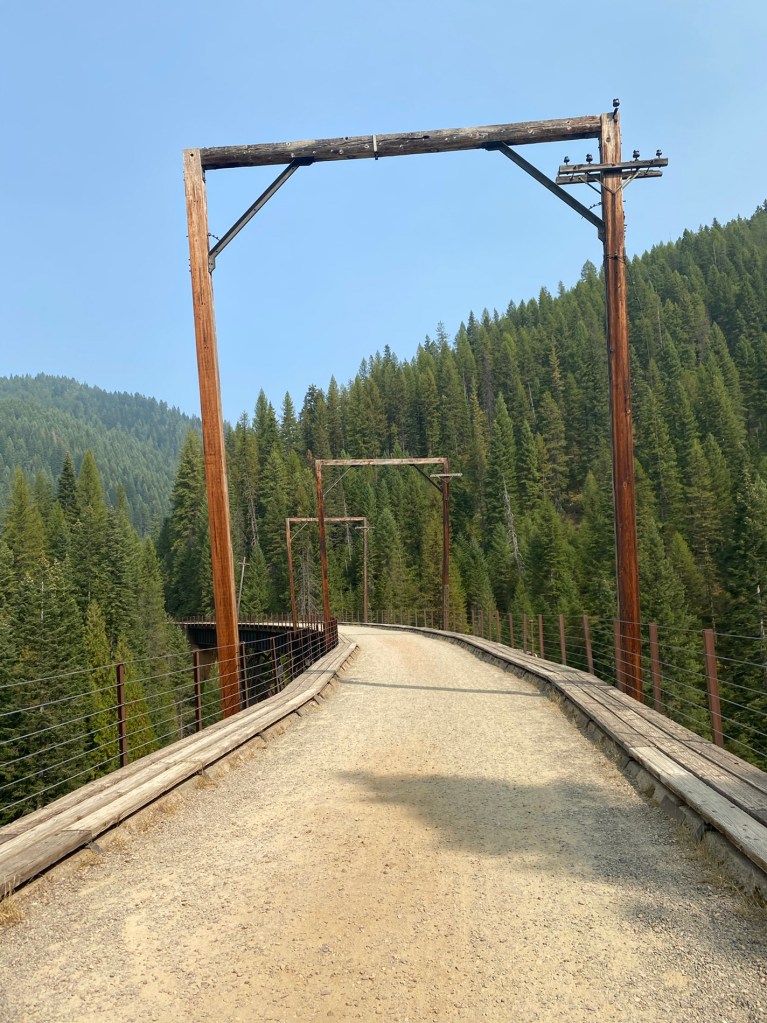
This summer, I heard about a Rail Trail called the “Route of the Hiawatha“, located in the Bitteroot mountains along the Idaho-Monatana Border. It is reported to be a “Hall of Fame” rail trail, featuring 10 tunnels and 7 trestles running along it’s 15 mile length on the former Chicago, Milwaukee and Puget Sound Railway. We considered doing a road trip to ride the trail, and when the idea of the cross country RV trip came up, I knew this was a stop we’d have to make.
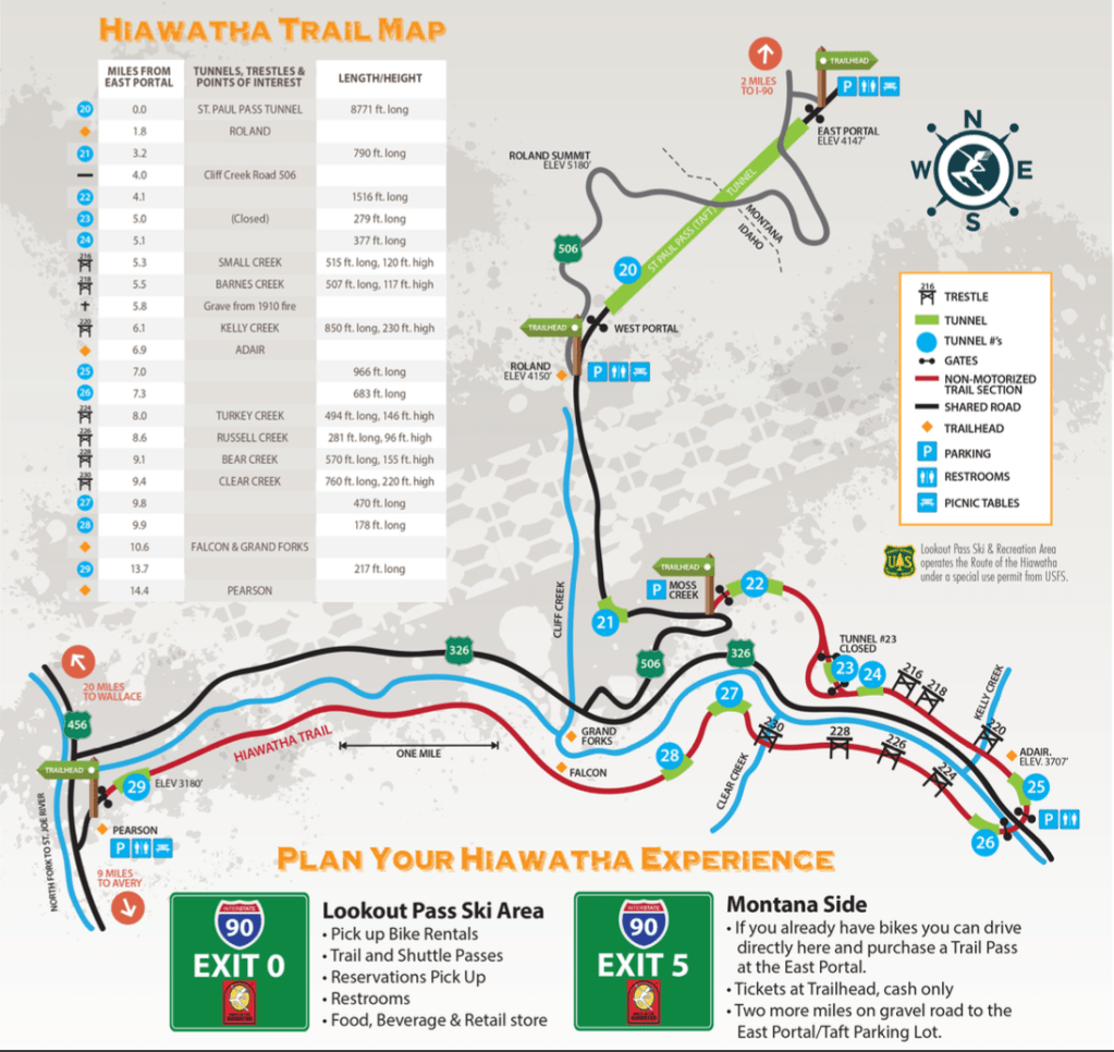
The trail is operated by Lookout Pass ski area, which rents bikes and runs a shuttle from the bottom of the trail back up to the top. The typical way to ride the trail is starting at the East Portal, riding through the 1.6 mile Taft tunnel and then taking the shuttle back from the lower, Pearson trailhead. We don’t want to be on a crowded shuttle with no mask requirements, so we arranged to have bikes delivered to Pearson.
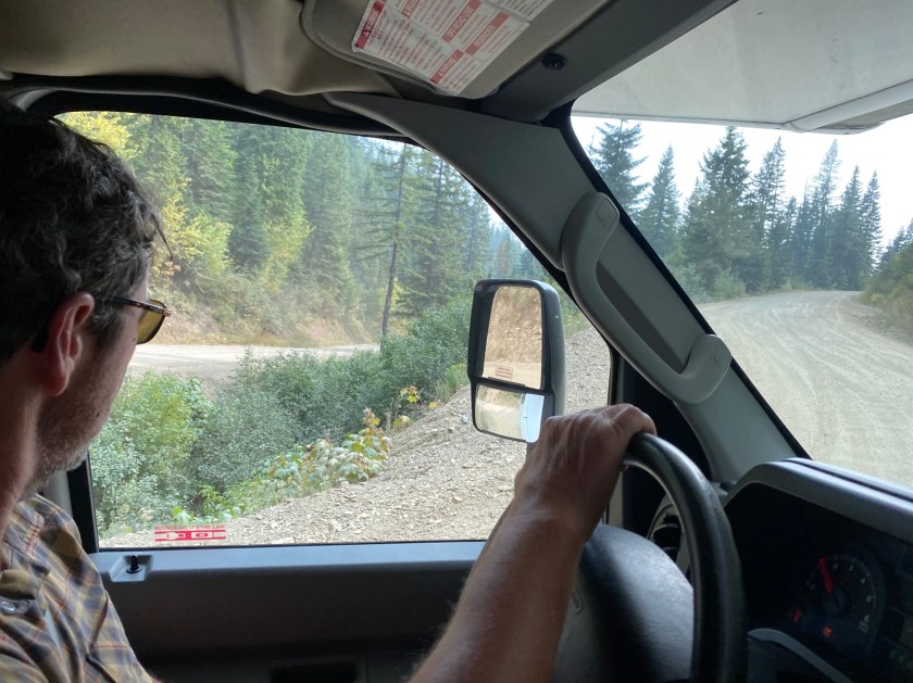
We read on the website that there was a good (20 mile) forest road that led from the town of Wallace to the Pearson trailhead. It started out great, with new blacktop pavement. And then the pavement ended, but there was a wide, well-graded dirt road. Which got narrower. And bumpier. And steeper, with lots of switchbacks. And we were on the outside of the road noticing the long dropoffs. The road goes up and over Moon Pass (I later learned that the top elevation was 4931 feet) and then descends down along the river to the trailhead. There were definitely some sketchy sections, more suited to the many off road vehicles around here than to our RV. Very exciting. The smoke, by the way, got pretty thick as we climbed out of Wallace, but the thinned out quite a bit on the other side.
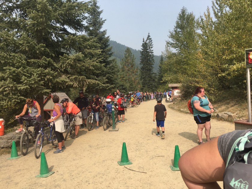
We arrived around 10 AM, when the bikes were supposed to be delivered, but no one was around. Soon we saw the first riders from the top finishing their ride. Eventually the bikes arrived, but without the powerful headlights that were supposed to be necessary for the 10 tunnels. The guy working at the bottom managed to come up with a dinky one for Miranda, but nothing for my bike. Fortunately we had some headlights with us. The bikes were in pretty rough condition and the shifting was badly out of adjustment. If you plan to rent bikes for the ride, we’d recommend upgrading from the basic bike.
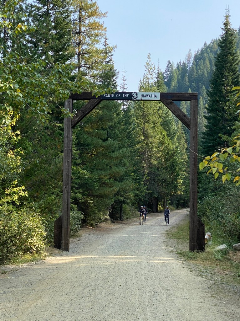
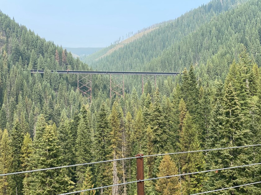
The ride was fantastic, along a well maintained gravel/dirt trail with lots of informational signs (which we mostly rode right by) and plenty of rest stops (same). It was a steady false flat grade of about 100 ft per mile, following the valley along one side of loop creek and then around to the other side. The trestles were absolutely spectacular, standing several hundred feet over the valley floor. In many places you could see the trestles on the other side of the valley.
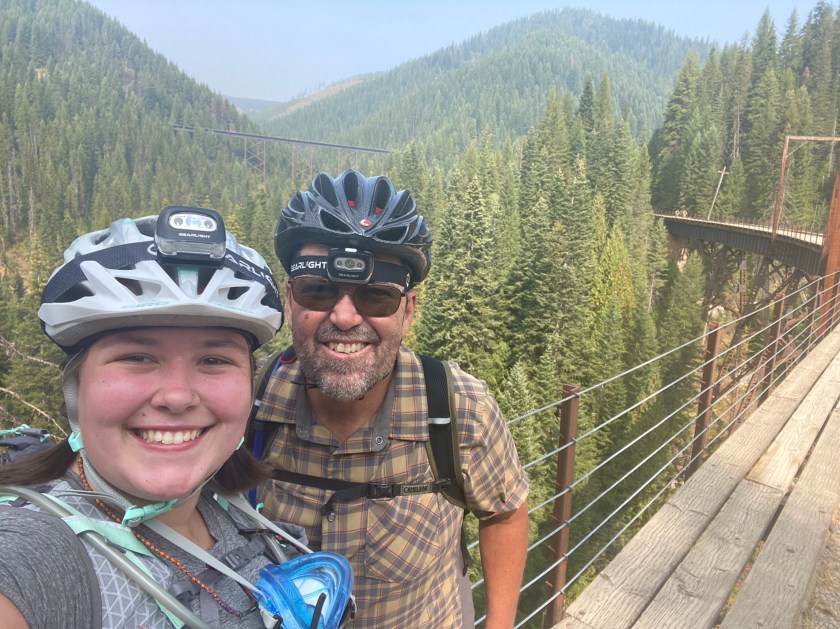
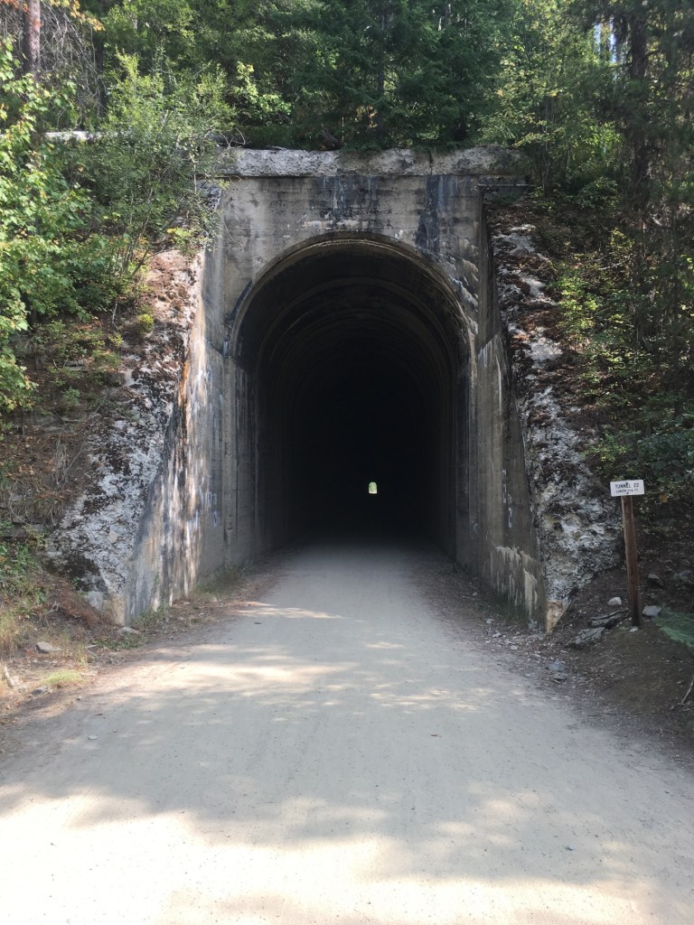
The tunnels were a fun and cool relief from the warm, sunny day. The ones that we passed through ranged from 200 to 1500+ feet in length – we did not go all the way to the 1.6 mile Taft tunnel at the top.
There were literally hundreds of people out on the trails riding every kind of bike you could imagine. A fair number of them were a bit clueless. Miranda suggested a mandatory lesson on trail safety and etiquette before allowing anyone to ride.
It was only as we were riding along the trail that I realized that this was the area of the Great Fire of 1910, which eventually burned 3 million acres across Idaho and Western Montana. I read an interesting book about this fire and the beginnings of the US Forest Service called The Big Burn. As it turned out, the fire burned along the North Fork of the St Joe River, and we saw many, many burnt, dead trees that must have been remnants from that fire. As we returned to the town of Wallace after the ride, the fire smoke was eerily thick (a good bit of Wallace was destroyed in the 1910 fire).
We were going to stay at an RV park in Wallace, but they were first-come first serve only and full, so we headed East on I-90. After passing a couple of sketchy RV parks including one behind a roadside “Casino” we arrived at the very nice Campground St Regis in Montana, where we cooked hobo dinners on the coals of a fire and roasted marshmallows for S’mores. All in all, a great adventure day! Next we are on towards Glacier National Park.

I’m enjoying the reports of your travels. I too read the book “The Big Burn” and it’s one of my all-time favorites. Bruce and I visited Wallace, ID and walked the trail described in the book to the mine shaft that the men sheltered in. There are sign posts along the trail describing what the men saw and endured trying to save themselves. Very sobering.
LikeLike
OMG!! What a wonderful adventure. I’ve never heard of Rail Trails on trestles and thru tunnels. Loved all the details. Aunt Jan
LikeLike
Great start to the adventure of a lifetime! I’d freak on the tressle bridge.💕🤗
Sent from my iPad
>
LikeLike
Jill and I are with Helen — we would absolutely freak on the trestle bridge. Probably would back out and insist on an alternate route!
LikeLike